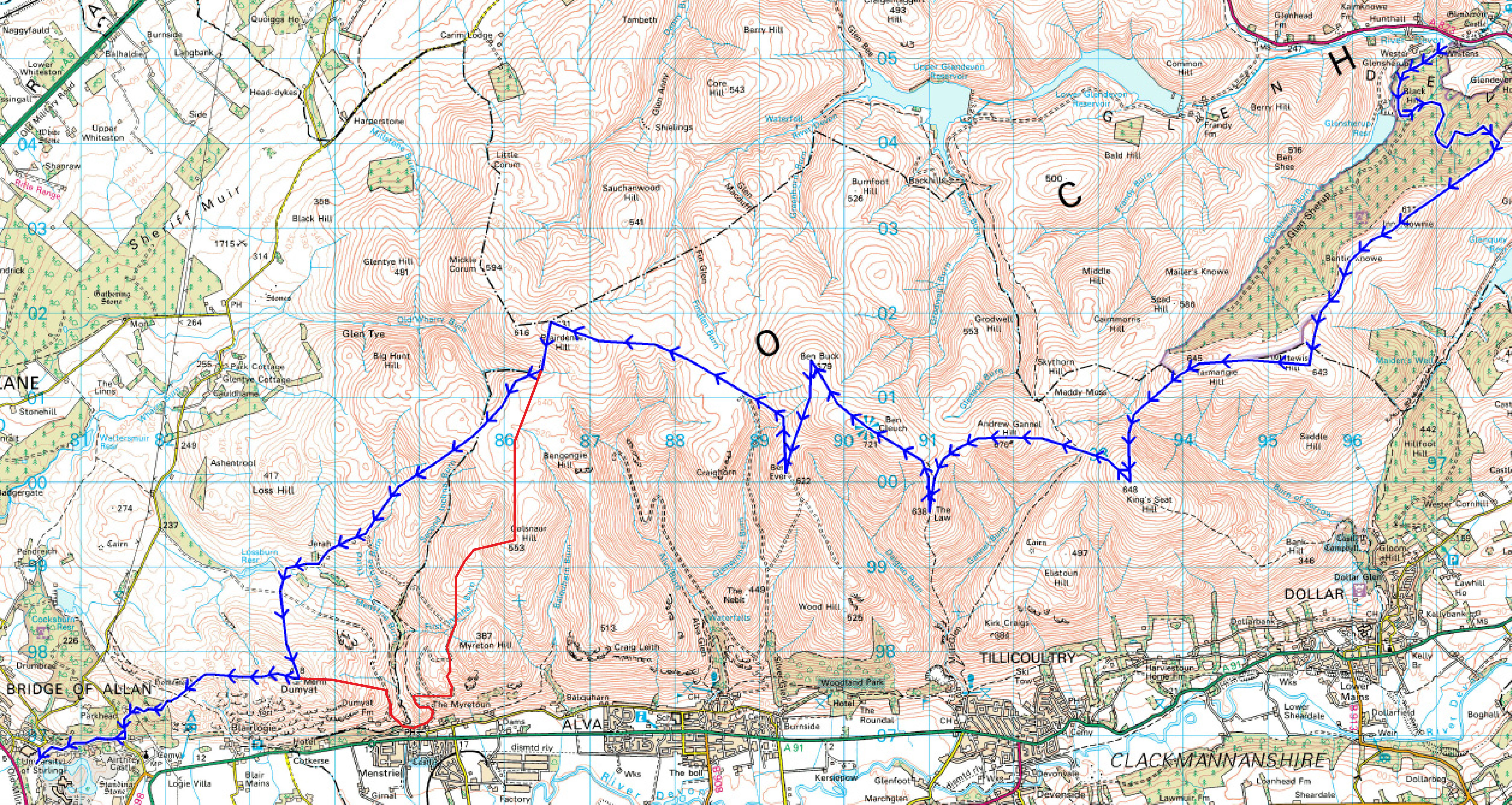
The Ochil 2000s is the next Long Series hill race (Aug 27th). It is longer than the Skyline (31.2kms), but has less height gain with ~1200m.
More details at:
http://www.scottishhillracing.co.uk/RaceDetails.aspx?RaceID=RA-0203
http://www.ochilhillrunners.org.uk/static.aspx?id=o2000R
If you want to enter, online registration is here:
http://www.ochilhillrunners.org.uk/RaceEntry.aspx?id=1712
However this year, there has been a route change as the final third of the race has been mucked up by substantial woodland planting up valley from Menstrie. For those of us who ran it last year, this plantation was a nightmare and would prove ever more difficult as the trees grew:
http://penicuikharriers.org.uk/2015/08/23/ochil-2000s/
The organisers have seen sense and changed the route. last Sunday, Andrea and I went to have a scout of the new route and here is my brief summary of the new route with implications for the whole race.
So – the 2016 Ochil 2000s route is the same except for the 6-8kms section between Blairdenon Hill and Dumyat. The figure below compares the old route in blue and the new section in red. Because of the drop down into Menstrie, the route is a tad longer and there is now more elevation loss/gain to Dumyat.

Ochils old and New
The next figure details the new route. Run SSW from Blairdenon and keep the fence on your right and continue straight down into the small valley and cross the small stream. Don’t contour to the east as you’ll get snarled up in the bog. Coming up out from the small burn, cross the fence (there is a new one) and keep the fence on your left. There are subtle signs of an old track, but importantly is far less boggy on this side of the fence. Navigation is now easy and you simply follow the fence and wall line until Colsnaur hill where there will be a checkpoint. This is a much less technical section than the old route and, although for me at least I will have been running for about 2.5 hrs, should be quite runnable even with the slight rise.

Ochils New
From Colsnaur, turn right, head west and down (you can see the Lossburn reservoir in the distance) and follow the thin grassy track (with some switchbacks) until you cross a new track road (not on map – I have eyeballed it in) where there us a deer fence gate. Keep running SSW downwards until you hit a track. Follow this track for about 400 meters and when it turns sharply right, keep straight and follow another grassy track down past the Dun. After about 500 meters, this track will itself turn right and will soon join the main track. Bar a few “short cuts” through some of the hairpin bends, you basically follow the track down into Menstrie. On hitting the road, turn right, cross the river and after a few 100 meters or so, you will see some steps up to the right that are the beginning of the track up to Dumyat. We did not bother to scout that as I assume the route will be obvious.
So – implications for distance and height of the new route.
From Blairdenon to Dumyat:
Old: ~6.3 kms, ~470 m loss and 230 m gain
New: ~8.5kms, ~670 m loss and 440 m gain
The new route is much more runnable but is longer and has more climb. My gut feeling is that it should probably not be much different to last year’s mess but hopefully less tiring on the legs. We’ll find out in 2 weeks. It might be possible to take a more direct line off Colsnaur across Menstrie Glen – certainly, the old Dumyat Dash route went somewhere through there – but I would be loath to experiment without a further exploration.
Rob
Ha – never crossed my mind!!!
Rob, excellent support feedback to the Club (afterthought, maybe he’s just laying a false trail????????? No, Rob would never stoop to that, would he???????????)
Well-scouted Rob and Andrea, I am very much looking forward to it!